Sulawesi
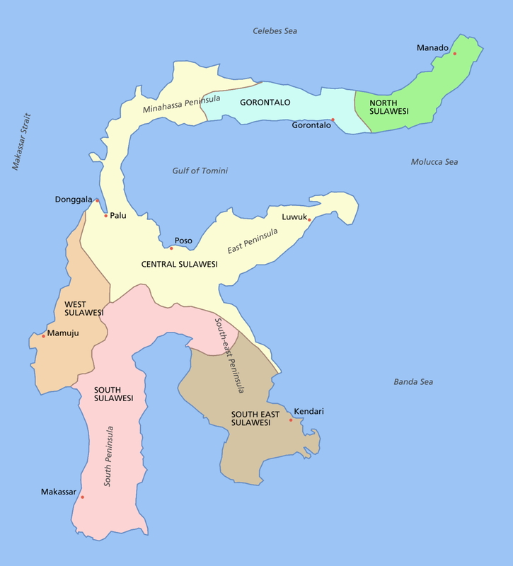
Sulawesi also known as Celebes is one of the four Greater Sunda Islands, and the world's eleventh-largest island. It is the 4th largest and, with a population of 21 million, the third most populous of the Indonesian islands. The landmass of Sulawesi includes four peninsulas: the northern Minahassa Peninsula, the East Peninsula, the South Peninsula, and the Southeast Peninsula. Three gulfs separate these peninsulas: the Gulf of Tomini between the northern Minahassa and East peninsulas, the Tolo Gulf between the East and Southeast peninsulas, and the Bone Gulf between the South and Southeast peninsulas. The Strait of Makassar runs along the western side of the island and separates the island from Borneo.
On our tour we flew from Depensar (Bali) to Makassar, on the south peninsula (the largest city of Sulawesi), early morning of 18th October. We did a day of birding and spent one night there. Next morning we flew from Makassar to Palu at the north of central Sulawesi and then drove for ~4 hours to Wuasa, where we stayed for four nights to explore the Lore Lindu National Park. On 23rd October we drove back to Palu where we stayed for 1 night, ready to fly on to Manado the next day (which has to be done via a return to Makassar as there are no direct flights). After arriving at Manado, at the eastern end of the Minahassa peninsula, we drove for ~5 hours to stay at Kotamobagu for 2 nights. From here we visited Tapakulintang. On 25th October we drove back to Manado and stayed one night in the Novohotel there. We then spent 6 nights on Halmahera and Ternate before returning to Sulawesi on 1st November. This time we drove for ~3 hours to stay at Tangkoko Lodge followed by 2 nights at Eremita Villa, Tomohon, before departing for home on 6th November.
On our tour we flew from Depensar (Bali) to Makassar, on the south peninsula (the largest city of Sulawesi), early morning of 18th October. We did a day of birding and spent one night there. Next morning we flew from Makassar to Palu at the north of central Sulawesi and then drove for ~4 hours to Wuasa, where we stayed for four nights to explore the Lore Lindu National Park. On 23rd October we drove back to Palu where we stayed for 1 night, ready to fly on to Manado the next day (which has to be done via a return to Makassar as there are no direct flights). After arriving at Manado, at the eastern end of the Minahassa peninsula, we drove for ~5 hours to stay at Kotamobagu for 2 nights. From here we visited Tapakulintang. On 25th October we drove back to Manado and stayed one night in the Novohotel there. We then spent 6 nights on Halmahera and Ternate before returning to Sulawesi on 1st November. This time we drove for ~3 hours to stay at Tangkoko Lodge followed by 2 nights at Eremita Villa, Tomohon, before departing for home on 6th November.
Halmahera and Ternate
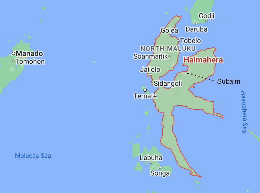
Halmahera is the largest of the Maluku (=Molucca) Islands. It is part of the North Maluku province of Indonesia, With a population of ~500,000 it is relatively sparsely populated. Most of its transportation links are via Ternate.
On 27th October we flew from Manado to Ternate and then got to Halmahera via speedboat. We stayed 1 night in Sofifi, the capital city of North Maluku, on the west coast of Halmahera and then drove for ~3 hours to reach our accommodation at Subaim. We stayed here for 3 nights (28th, 29th & 30th October) before returning to Ternate for 1 night (31st October).
In travelling from Sulawesi to Ternate we crossed a time zone and Wallace's line - the boundary between the Asian and Australasian biogeographic zones.
