Carn Dearg (945m) (Munro 111)
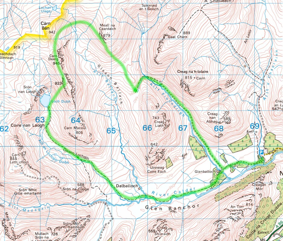
Distance: 18.5km; Ascent: 750m; Time: 6h45m
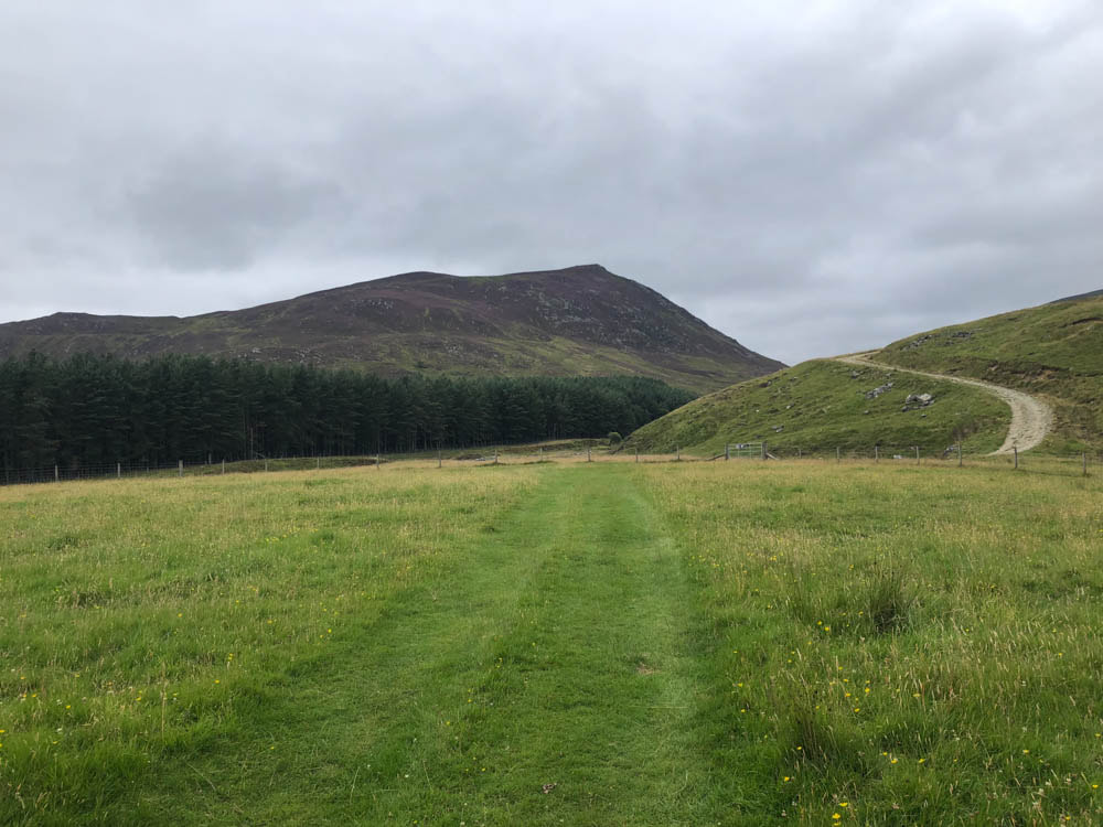
View of Creag Liath near the start of the walk at Glenballoch (the only picture I took today)
Carn Dearg is one of 3 Munros on a Walk Highlands circuit of the Monadhliath mountains; we had done the other two on a previous visit. We probably shouldn't have started this walk today as we could see the tops were covered, but we set out with the optimistic idea that it might clear. It didn't - it got worse!
We parked at the end of the road to the moor above Newtonmore. There is a clear and fairly easy track from the car park to Glenballoch and then beside Allt Fionndrigh for the first 3-4km. It started raining and didn't really stop for the next 4-5 hours while we walked on undaunted but regretting we hadn't waited until the next day (which turned out to be dry). The track soon deteriorates and becomes untraceable as it crosses boggy peat hags towards and across the flanks of Meall na Ceardaich, around the head of Gleann Ballach. By now we were well in the clouds and visibility was very limited. Navigation was further hampered by my iphone not responding to my wet fingers. Eventually we picked up a path on the final km or so of the ascent to Carn Dearg. We barely noticed the top as we continued on across the summit ridge to the 923m cairn, where I got the phone app to work and realised we had passed the summit already. We then made the very steep pathless descent coming out of the cloud to the extremely scenic Loch Dubh with its 4 or 5 gushing waterfalls on its NW flank - where we stopped for a rapid bite of lunch. The track marked on the map from here through Gleann Lochain is intermittent as it passes through very boggy ground, but there was no difficulty in navigation and progress was fairly rapid as we followed the course of the Allt an Lochain Duibh to it convergence with the River Calder. Here the track is more definite and we eventually got back to the car very wet.
We parked at the end of the road to the moor above Newtonmore. There is a clear and fairly easy track from the car park to Glenballoch and then beside Allt Fionndrigh for the first 3-4km. It started raining and didn't really stop for the next 4-5 hours while we walked on undaunted but regretting we hadn't waited until the next day (which turned out to be dry). The track soon deteriorates and becomes untraceable as it crosses boggy peat hags towards and across the flanks of Meall na Ceardaich, around the head of Gleann Ballach. By now we were well in the clouds and visibility was very limited. Navigation was further hampered by my iphone not responding to my wet fingers. Eventually we picked up a path on the final km or so of the ascent to Carn Dearg. We barely noticed the top as we continued on across the summit ridge to the 923m cairn, where I got the phone app to work and realised we had passed the summit already. We then made the very steep pathless descent coming out of the cloud to the extremely scenic Loch Dubh with its 4 or 5 gushing waterfalls on its NW flank - where we stopped for a rapid bite of lunch. The track marked on the map from here through Gleann Lochain is intermittent as it passes through very boggy ground, but there was no difficulty in navigation and progress was fairly rapid as we followed the course of the Allt an Lochain Duibh to it convergence with the River Calder. Here the track is more definite and we eventually got back to the car very wet.