Dale Head (753m) and Hindscarth (727m) (~15km, ascent ~800m, 7 hrs) 20/11/2015
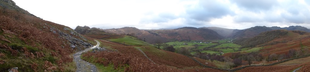
Starting from the Borrowdale Gates hotel we set off south at 09:00 along the Cumbria way. After 1.5km we left the Cumbria Way to ascend Castle Crag through woodland alongside Broadslack Gill. After another 1.5km we turned west to make the steep ascent alongside Tongue Gill through the disused Rigghead quarries, eventually reaching open and occasionally very windy moorland at ~500m. Here there are 3 good choices for a circular route: - along the High Spy - Catbells ridge, which we have done several times before; the steep descent into the valley to Little Town, which we did last year; or our chosen route. We crossed a stream and passed Dalehead Tarn and then made the steep ascent to the top of Dale Head, bracing ourselves against strong gusts of wind and hail on several occasions along the way. Unfortunately the top was in cloud. We continued slightly down along Hindscarth Edge before turning north to reach the summit of Hindscarth. From here we made the long descent, with several steep and slippery sections, down to the river at low Snab farm. Here we crossed on a foot bridge to regain the eastern side of the stream and continued north to Little Town. From here we turned west to ascend and cross the ridge south of Catbells and then made another steep descent to Manesty. Another 1km along the road and we were back at the hotel at dusk 16:00.
Starting from the Borrowdale Gates hotel we set off south at 09:00 along the Cumbria way. After 1.5km we left the Cumbria Way to ascend Castle Crag through woodland alongside Broadslack Gill. After another 1.5km we turned west to make the steep ascent alongside Tongue Gill through the disused Rigghead quarries, eventually reaching open and occasionally very windy moorland at ~500m. Here there are 3 good choices for a circular route: - along the High Spy - Catbells ridge, which we have done several times before; the steep descent into the valley to Little Town, which we did last year; or our chosen route. We crossed a stream and passed Dalehead Tarn and then made the steep ascent to the top of Dale Head, bracing ourselves against strong gusts of wind and hail on several occasions along the way. Unfortunately the top was in cloud. We continued slightly down along Hindscarth Edge before turning north to reach the summit of Hindscarth. From here we made the long descent, with several steep and slippery sections, down to the river at low Snab farm. Here we crossed on a foot bridge to regain the eastern side of the stream and continued north to Little Town. From here we turned west to ascend and cross the ridge south of Catbells and then made another steep descent to Manesty. Another 1km along the road and we were back at the hotel at dusk 16:00.
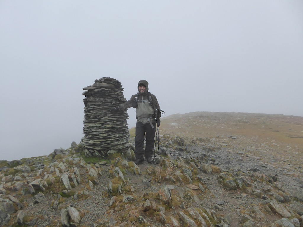
Me in the clouds at the top of Dale Head on my 58th birthday.
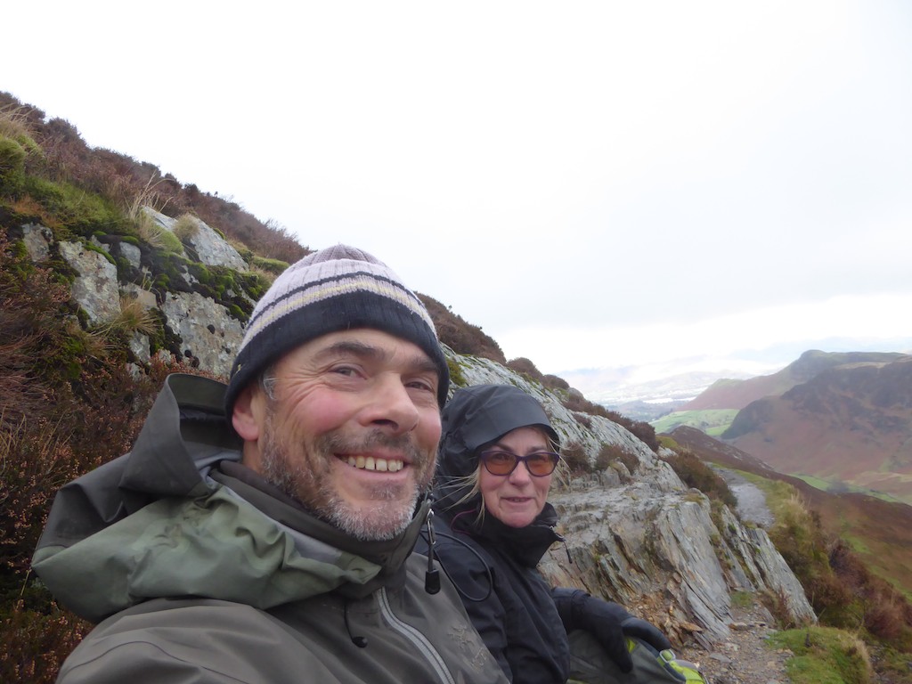
A selfie - having lunch on a narrow path across a steep slope - but we had a nice stone seat, a good view and despite the exposed position it was sheltered from the wind and it had stopped raining. Catbells is the prominent hump on the further ridge to the right.
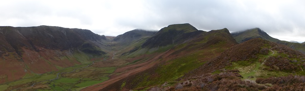
Looking back on our route from the descent ridge (Scope End). On the left are Eel Crags below High Spy. At the head of the valley with its summit still in the clouds is Dale Head. The next peak to the right is Hindscarth and from there our descent route can be traced. (The peak further to right is Robinson)
